•The most reliable way to find a neighborhood's edge today is by its square and its corridor — not by a color-coded zoning district.
•The old zoning map no longer marks borders. A recent reform merged every residential district into one, so the shading is now identical citywide.
•The City still publishes 13 official neighborhoods, and their lines follow streets, squares, and corridors — that map is your tiebreaker, not the listing site.
•Bottom line: anchor any address to its nearest square, trace its corridor, then confirm against the City's 13-neighborhood map.
# Where Do Cambridge's Neighborhoods Actually Begin and End?
Most buyers assume Cambridge's neighborhoods are drawn by old zoning lines. That assumption held up for decades. It recently stopped being reliable.
The City Council adopted two zoning petitions allowing multifamily housing citywide. As the City's Community Development Department put it: "for the first time in Cambridge zoning history, all residential neighborhoods have the same zoning rules." The Boston Globe called it one of the first moves in Massachusetts to eliminate single-family zoning.
Here's why that matters to you. The old zoning map no longer tells you "this is a quiet single-family block" or "this is a denser area." To find where a Cambridge neighborhood actually ends, you now read the city by its squares and corridors — not by a zoning color.
Why Don't the Old Zoning Lines Define Cambridge Neighborhoods Anymore?
For years, Cambridge was easier to read on a zoning map. Residence A-1, A-2, B, and C districts created visible edges between lower-density blocks and denser ones. Buyers often treated those lines like neighborhood borders.
That's no longer how the map works. The reform collapsed those residential districts into one Residence C-1 district — a single, shared set of building rules for every home. The City's Community Development Department FAQ says it plainly: "All Residence A-1, A-2, B, and C are now Residence C-1 districts."
Councilor Burhan Azeem said the old zoning map resembled "a copy... of a redlining map." The goal, he said, was "our whole city growing together as one with a unified residential district."
So you can no longer look at district shading and assume it marks where one neighborhood ends. That shading is now identical citywide for residential areas.
Key point: Cambridge still publishes a 13-neighborhood map, and those lines follow streets, squares, corridors, and local identity — not the old zoning categories.
What Are Cambridge's Official Neighborhoods?
Cambridge's official neighborhood map includes these areas:
•East Cambridge
•MIT / Area 2
•Wellington-Harrington
•The Port
•Cambridgeport
•Mid-Cambridge
•Riverside
•Agassiz
•Neighborhood Nine
•West Cambridge
•North Cambridge
•Cambridge Highlands
•Strawberry Hill
If you're buying, selling, or renting, this list matters because listing sites often use looser names. The differences are measurable: Mid-Cambridge has 49.5 residents per acre, while Cambridge Highlands has 9.1 residents per acre.
Population Density by Cambridge Neighborhood
Neighborhood-level population density using ACS 2018-2022 population per acre from Table 4.
For a buyer, that contrast is a lifestyle signal — denser neighborhoods feel more urban and walkable, while low-density ones feel quieter and more suburban.
A property can be marketed as "near Harvard," "Inman area," or "Porter-adjacent." Those labels can be useful, but they're not the official boundary. Neighborhood names also shape buyer expectations, pricing, school searches, commute assumptions, and resale positioning.
How Should You Read Cambridge by Its Squares and Corridors?
Use a simple method: anchor the address to a square or a corridor, then read outward to the seams.
Corridors are the real spines. Massachusetts Avenue connects Harvard Square, Porter Square, and North Cambridge. Cambridge Street carries you from Inman Square east toward East Cambridge. These roads orient you when an edge feels unclear.
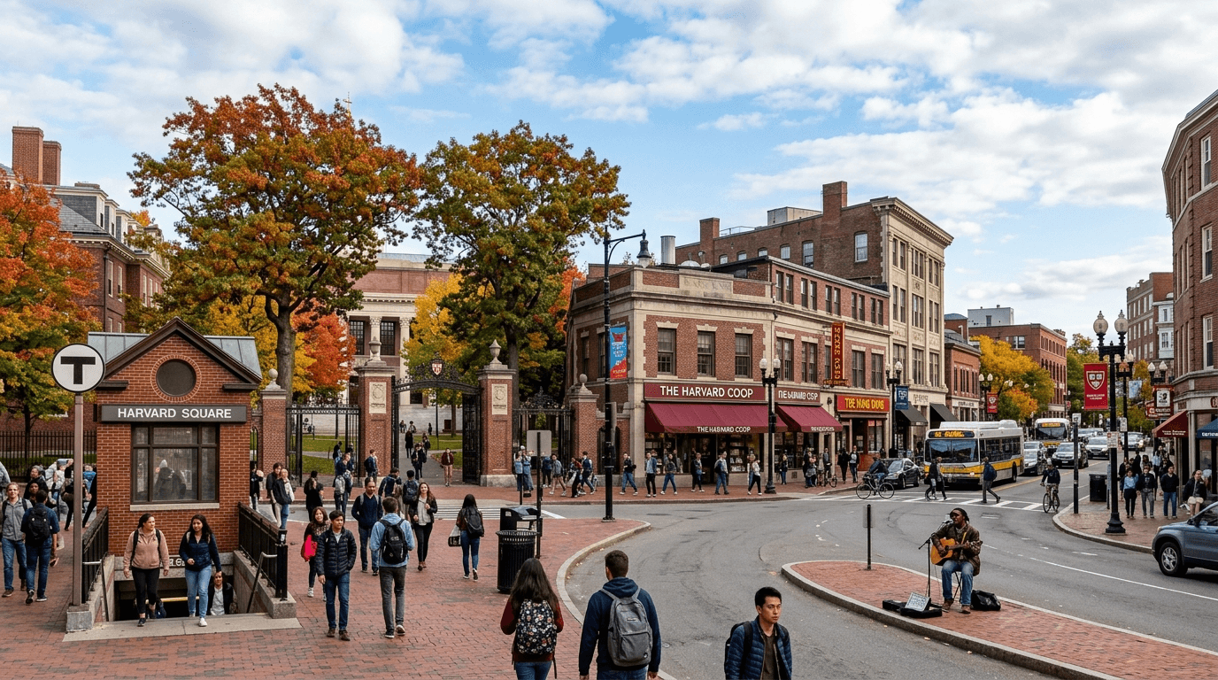
Squares are your anchors. Harvard, Central, Kendall, Inman, and Porter each pull the surrounding blocks toward them. A neighborhood often "ends" where one square's daily-life pull gives way to another.
For a buyer, the practical question is simple: where would you naturally walk for coffee, groceries, dinner, or the T? That answer often lines up better with the City's label than a marketing description does. The City appears to organize place this way too, drawing zones around named squares such as Central, Kendall, Harvard, Inman, and Porter.
Where Do Cambridge Neighborhood Boundaries Get Fuzzy?
Some edges are easy. Others aren't. The most confusing areas are the seams where daily life overlaps.
Between Central Square and the Charles River, Cambridgeport, Riverside, and The Port can blur together. Mid-Cambridge can feel like it sits between Harvard and Central. Inman can blend into Wellington-Harrington. A buyer may think they bought in one neighborhood while the City map places them in another.
So be careful with listings. Agents sometimes reach for the more marketable nearby name, which doesn't always mean the property sits officially inside that neighborhood. If the address is near a border, don't rely only on the MLS (the listing database agents use) — check the City's 13-neighborhood map.
One rental detail is worth knowing if you rent before you buy. Under the Massachusetts budget signed by Gov. Healey on July 4, 2025, renter-paid broker fees are eliminated effective August 1, 2025. As Todd Kaplan of Greater Boston Legal Services put it, "If the landlord hires the broker, the landlord should pay the fee." That matters because a broker fee often runs about a month's rent — near a seam, that savings can affect how much cash you keep for a down payment.
What Are the Best Arguments Against a Map-First Guide?
There are three fair objections.
If every residential district is now one zone, is the neighborhood map meaningless?
No. Zoning uniformity and neighborhood identity are different things. The rezoning unified the residential zoning category; it didn't erase named neighborhoods, squares, or corridors. Corridor-specific planning along Mass. Ave, Cambridge Street, and Porter Square shows the City still treats places differently. The official map still helps you read location, lifestyle, and resale context.
If taller buildings are possible, will Cambridge's neighborhood feel disappear?
Not everywhere, and not the same way on every block. The higher limits are conditional and corridor-focused, not a blanket rule for every side street. Confirm the current corridor height and multifamily rules with the City's Community Development Department, since the exact thresholds and dates are still in flux. For buyers, the takeaway is practical: look closely at the block, the lot sizes, and the nearby corridors.
Will this guide be out of date if Cambridge keeps changing its housing rules?
The zoning picture is shifting. A lawsuit over the Inclusionary Housing Ordinance (the city's affordable-housing requirement) sits in Land Court (a Massachusetts court for property disputes), adjustments to the multifamily rules have been proposed, and the corridor heights remain recommendations, not law. So date-stamp the zoning rules with your agent. But the named-neighborhood boundaries are more stable than the building rules layered on top of them.
The neighborhood lines hold. The building rules are the moving target.
How Can You Place Any Cambridge Address in the Right Neighborhood?
Use this three-step check:
1. Find the nearest square. That's your anchor — it tells you which neighborhood's daily-life pull you're likely in.
2. Trace the corridor. Mass. Ave, Cambridge Street, and other main roads help you read direction and seams.
3. Confirm with the City's official 13-neighborhood map. This is the authoritative tiebreaker when a listing label feels unclear.
Then connect the map to your decision. Because Residence C-1 allows denser building on many lots, don't assume old zoning will freeze your block in place. Choose a home for its actual setting: the street, nearby square, transit, light, noise, parking, and the feel of the surrounding blocks.
That's the durable way to buy in Cambridge now. The old district edges are fading. The squares and corridors still explain how the city works.
Want help placing a specific address inside the correct Cambridge neighborhood? Send me the address, and I'll walk you through the map — and what nearby zoning changes could mean for value.